/cdn.vox-cdn.com/uploads/chorus_asset/file/24858967/202308171800_202308180050_g18_fd_geocolor_hilary_woth_conus_smoke_nolabels.png)
The National Hurricane Center issued a tropical storm watch for southern California today as Hurricane Hilary barrels toward the US and Mexico. This is the first time this kind of alert has been issued for sunny SoCal, which is more prone to drought and fire this time of year than hurricanes.
A tropical storm watch means “that tropical storm conditions are possible within the watch area, generally within 48 hours,” according to the National Hurricane Center. The watch is in place from the Mexico-California border to the Los Angeles-Orange county line as well as for Catalina and Santa Barbara Islands.
A tropical storm watch means “that tropical storm conditions are possible within the watch area, generally within 48 hours”
There are higher levels of alert across Mexico’s Baja California peninsula, with some areas subject to a hurricane watch and other areas under a hurricane warning. Hurricanes have higher wind speeds than tropical storms. And unlike a “watch” that means the storm conditions are possible, a hurricane warning means that hurricane conditions are expected.
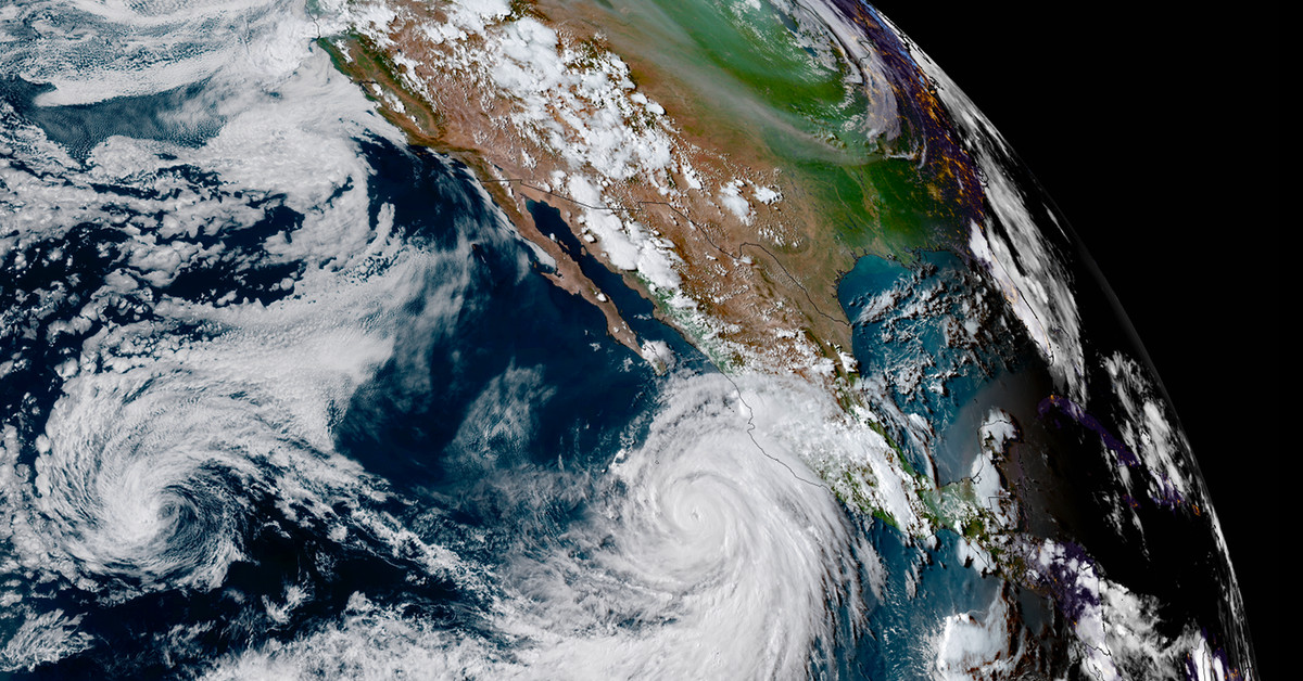
Hilary has strengthened into a Category 4 hurricane, with wind speeds near 145mph. The National Hurricane Center is warning residents about heavy rainfall that could make “rare and dangerous flooding” possible in parts of Southern California and Nevada.
Hilary is forecast to dump between three and six inches of rain — but a maximum of up to 10 inches in some locations. The deluge is expected to last through Sunday night in Baja California. In the southwestern US, rainfall peaks on Sunday and Monday and then lingers through Wednesday.
California is usually spared from hurricanes because of cooler waters off its shores. Tropical storms gather strength from heat energy in warm water, and one hasn’t made landfall in California since 1939 (before officials started issuing alerts for named storms). But the Eastern Pacific is unusually warm this season thanks to a one-two punch from climate change and El Niño. And warmer air can also hold more moisture, adding to the rising flood risk in California as global temperatures rise.
“The frequency and intensity of many extremes, such as heatwaves and heavy precipitation, have increased in recent decades. There is high confidence that human induced climate change from greenhouse emissions, is the main driver,” World Meteorological Organization climate expert Alvaro Silva said in a media briefing and press release today. “This is the new normal and does not come as a surprise.”
Services Marketplace – Listings, Bookings & Reviews