
The European Space Agency (ESA) has shared remarkable images showing one of its satellites in what it describes as a “tumbling descent.”
ESA’s European Remote Sensing 2 satellite (ERS-2) is expected to burn up during reentry into Earth’s atmosphere on Wednesday.
The images (below) were captured around three weeks ago by Australian commercial imaging company HEO when the satellite was at an altitude of around 150 miles (300 kilometers).
ERS-2 spotted! 📸🛰️
The ESA satellite is on a tumbling descent that will lead to its atmospheric reentry and break up this week.
These images of ERS-2 were captured by @heospace for @spacegovuk using cameras on board other satellites.#ERS2reentry pic.twitter.com/GTuubP6apJ
— ESA Operations (@esaoperations) February 19, 2024
ERS-2 has since descended to an altitude of around 125 miles (200 km) and is falling by more than 6.2 miles (10 km) per day, with its speed rapidly increasing.
ESA said that when the 5,000-pound satellite descends to about 50 miles (80 km), it will start to break into pieces, most of which will burn up before they reach the ground. The space agency adds that the risk to people and property is extremely low, and that, “on average, an object of similar mass reenters Earth’s atmosphere every week or two.”
The satellite’s reentry is described by ESA as “natural” as the agency no longer has any control over it. “The only force causing ERS-2’s orbit to decay is atmospheric drag, which is influenced by unpredictable solar activity,” the agency said.
On Monday, ESA said it expects the satellite to meet a fiery end on Wednesday at 15:41 UTC (10:41 a.m. ET), though it could happen up to 11 hours on either side of that time. The reentry location is also hard to predict at the present time, though upcoming forecasts shared on ESA’s website will become increasingly accurate.
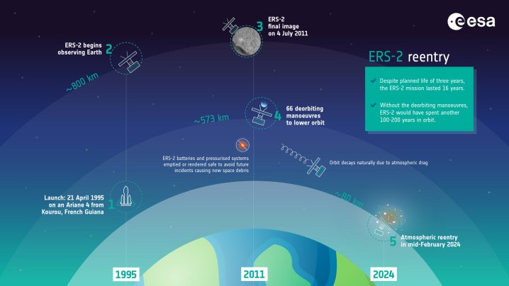
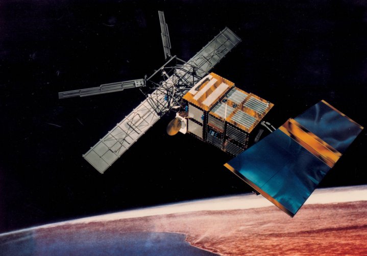
ERS-2 launched from Europe’s spaceport in Kourou, French Guiana, in 1995, and orbited Earth at an average altitude for 488 miles (785 km). The mission gathered valuable data on Earth’s land surfaces, oceans, and polar caps, while also capturing imagery of natural disasters such as flooding and earthquakes.
The mission ended in 2011 when ESA decided to deorbit the satellite to reduce the chances of it colliding with other satellites or space debris, thereby causing even more hazardous space junk.
Editors’ Recommendations
Services Marketplace – Listings, Bookings & Reviews