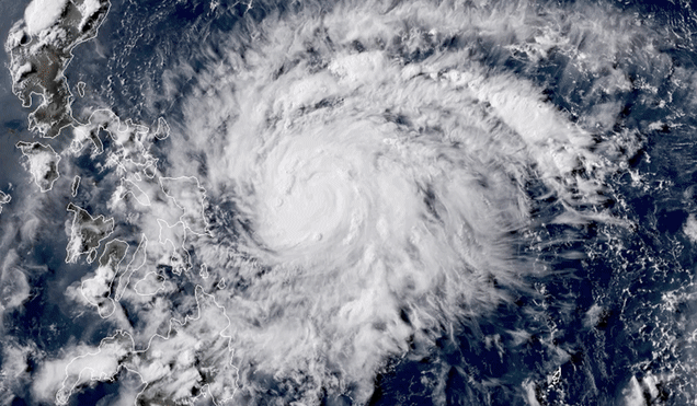
The first named typhoon in the western Pacific this year has arrived, and it’s already roaring. Typhoon Vongfong formed on Tuesday and rapidly intensified into a fierce pinwheel of a storm streaking toward the Philippines.
Advertisement
The island nation has already had a rough go of it this year, with a volcanic eruption in January and a climbing number of coronavirus cases. Though the curve hasn’t been as steep as some other countries such as the U.S., the approaching typhoon could change that as it buffets the country’s most populous island with heavy rain and strong winds to end the week.
Typhoon Vongfong—known the Philippines as Typhoon Ambo—spun up from a weak tropical storm to a robust Category 2-equivalent storm in less than 24 hours. As of late Wednesday night local time, the storm was packing sustained winds of 103 mph. The storm has undergone textbook rapid intensification, a meteorological process where typhoons see wind speeds increase at least 35 mph in 24 hours. The process occurs when tropical cyclones have access to a relatively calm atmosphere and hot water to feed off of. The latter is becoming more common as the climate crisis deepens, and rapidly intensifying storms are also becoming more common partly as a result.
The Joint Typhoon Warning Center is forecasting even further intensification over the next 24 hours. Vongfong is expected to reach Category 4 status with winds of 132 mph. That would also make it a super typhoon, words you don’t really want to hear ever, but particularly during a pandemic.
If there’s one saving grace about the storm, it’s that the radius of the winds is relatively small. Hurricane-force winds extend only 17 miles from its core, and tropical storm-force winds only extend out 90 miles. I would like to briefly note that if tiny Vongfong were a subtropical as opposed to tropical cyclone, it would officially be a neutercane, which will never not be funny. Moving on.
While Vongfong is a small storm, it’s still cause for concern. It’s track will take it right up the east coast of Luzon, the Philippines’ main island. The small size won’t stir up a lot of storm surge, but its winds could still pack a punch where they land. In addition, the storm could drop up to 20 inches of rain in some locations, leading to flooding.
Advertisement
Evacuations are underway in some locations. In an effort to deal with the new reality of a coronavirus that spreads easily when people are in close contact, some evacuation centers are being disinfected. Officials are also expanding the amount of space available in an effort to allow people to social distance as much as possible.
The efforts underway in the Philippines are a preview of what other coastal areas can expect in an era where coronavirus and weather disasters are only just beginning to meet. Atlantic hurricane season begins on June 1, though there’s a high chance the first storm of the season could develop by early next week. The season is forecast to be busier than usual, so regardless of when the first storm approaches land, it’s time to buckle up now.
Advertisement